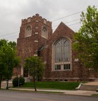


The church is located on the southern edge of downtown Minneapolis at Nicollet and Franklin Avenues. It’s bounded by Nicollet (and the Stevens Square neighborhood) on the east, Franklin (and the Whittier) on the south, LaSalle Ave. (and Loring Heights) on the west and Groveland Ave. (and downtown) on the north.
Plymouth Church can be reached via Metro Transit buses Nos. 2, 17 and 18.
As you approach downtown Minneapolis, take I-94 West to the Lyndale-Hennepin exit.
Stay in the right lane.
Turn right on Dell Place very shortly after leaving freeway.
Turn right on Groveland to LaSalle.
Right on LaSalle for one-half block.
Turn left into the church parking lot.
Go east on I394.
Follow the Downtown exits and exit at 12th St. Stay on 12th to LaSalle; turn right.
Go south on LaSalle, cross Groveland.
Go a half block and enter the church parking lot on the left.
Take the Hennepin/Lyndale Avenue exit.
Continue on Hennepin or Lyndale Avenues to Franklin Ave.
Turn left at Franklin.
Continue on Franklin until you cross Blaisdell Ave. on your right (LaSalle on your left).
Plymouth is on your left occupying the entire city block.
Enter the parking lot from Franklin Avenue (left turn).
I-94 West to the Lyndale-Hennepin exit.
Stay in the right lane.
Turn right on Dell Place very shortly after leaving freeway.
Turn right on Groveland to LaSalle.
Right on LaSalle for one-half block.
Turn left into the church parking lot.
Free surface lot areas available near the hall.

Nearby Recommendations from Google
